




Entiat Valley Roadbook Collection
Start (DZ) and Finish (FZ) at Coopers General Store
Total distance: 658 km
Road/terrain types in roadbook: Pavement, Graded gravel, 2 Track, Overgrown 2 Track, Rough 2 Track, Jeep
General description: The collection includes 5 great roadbooks. They all start and finish at the Coopers General Store where there is fuel available. There is camping nearby at campgrounds (including Pine Flats CG) and many dispersed camp sites. The routes offer a great mix and variety of terrain, road types, elevations, views and even temperatures. You will be riding from high mountains to river valleys to desert landscapes. Most of the routes are Pavement, Gravel and/or 2 Track. There is some more difficult terrain and the roadbooks offer options to go around them.
This is NOT a race! No hazards are marked.
Boundaries around Entiat Valley Roadbook Collection area: N – Lake Chelan; E – Columbia River; S – WA-2; W – Chumstick Highway, Shady Pass Road
Includes the following roadbooks:
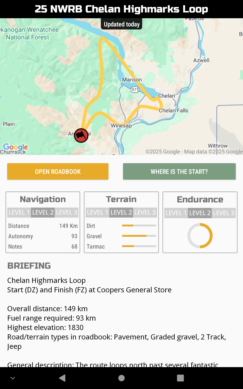
Chelan Highmarks Loop
Start (DZ) and Finish (FZ) at Coopers General Store
Overall distance: 149 km
Fuel range required: 93 km
Highest elevation: 1830
Road/terrain types in roadbook: Pavement, Graded gravel, 2 Track, Jeep
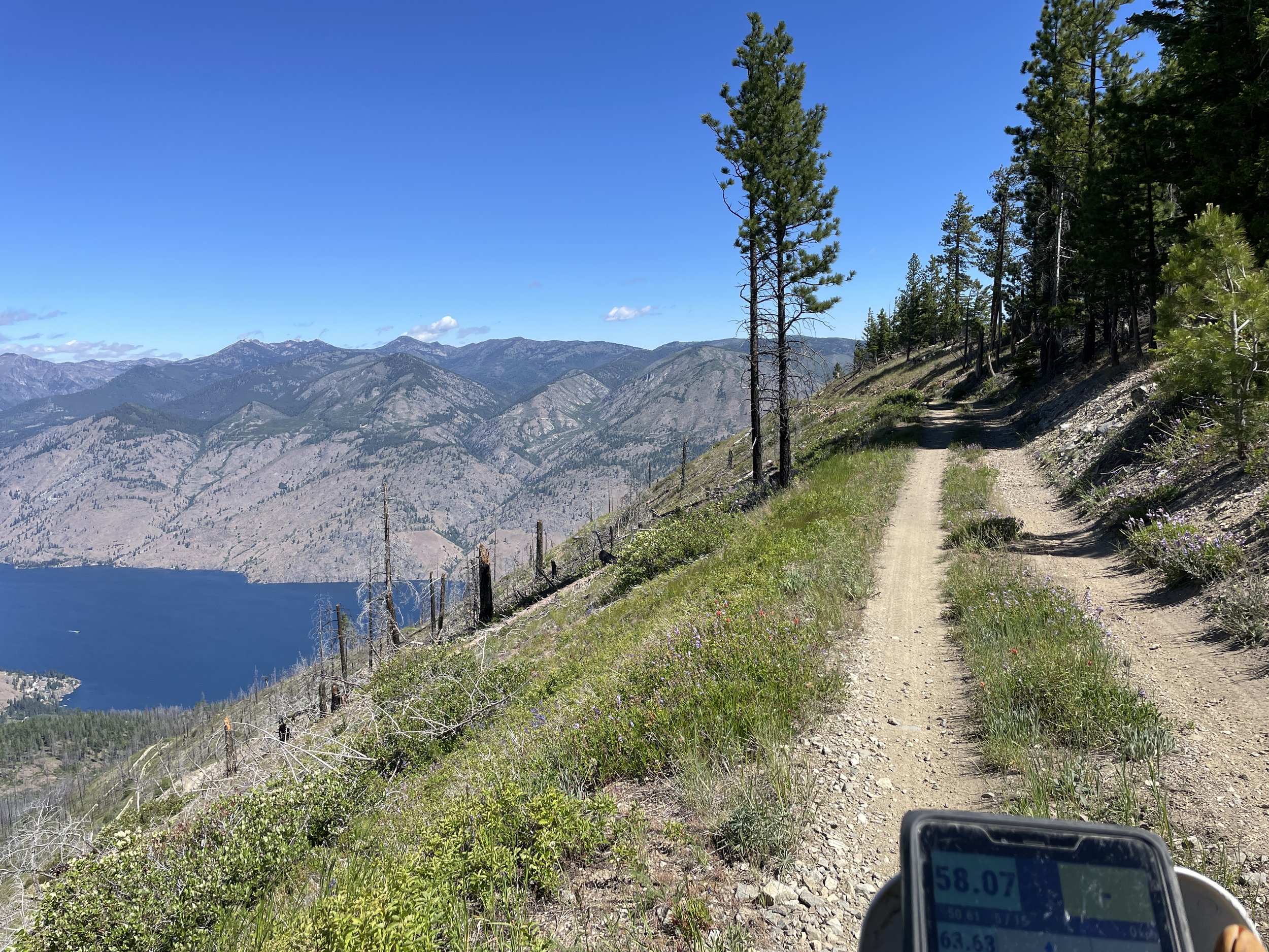
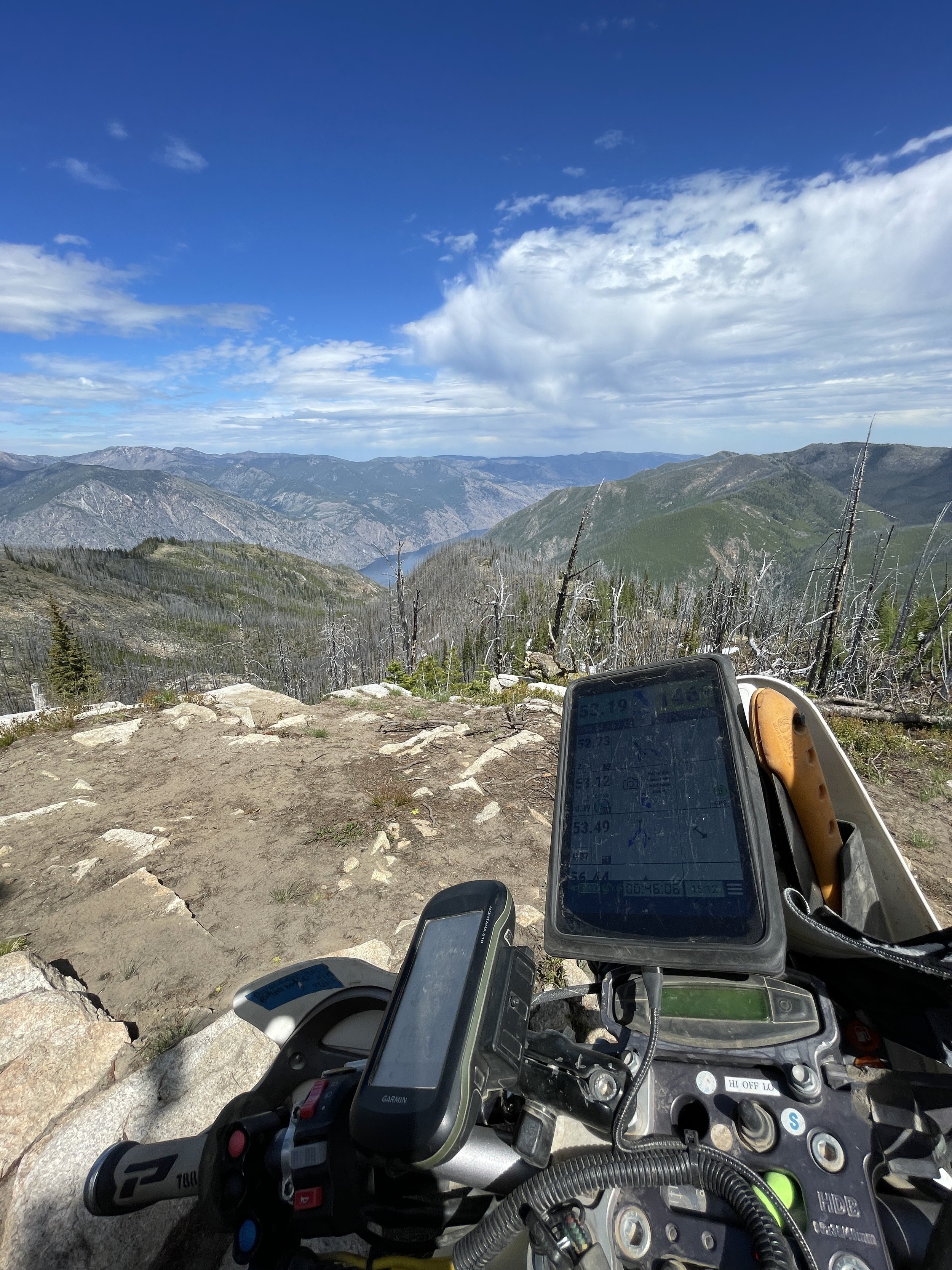
General description: The route loops north past several fantastic views of Lake Chelan and east over Chelan. It does not take long to get off the pavement and on to some fantastic gravel and graded roads. So many viewpoints! As it approaches Lake Chelan, it makes a steep descent down thru a rough 2 track Jeep section before returning to graded gravel. (There is an easier bypass on switch-backed graded gravel road around this descent in the roadbook.) It then takes you along the beautiful lake to the outskirts of Chelan. Next is a climb up to another high viewpoint where you may discover some other folks out enjoying the landscape in an unexpected way. After enjoying the view, you will find yourself following a curvy graded road thru some different vegetation before a quick jaunt on the highway down to the Columbia River. And then another climb back over the hills before dropping back down toward your starting point. There are so many places to stop for pics on this one!
Boundaries around roadbook area: N - Lake Chelan; E – Columbia River; S- Entiat River Road, W- Entiat River Road, Stormy Mountain, Pot Peak, Grouse Mountain
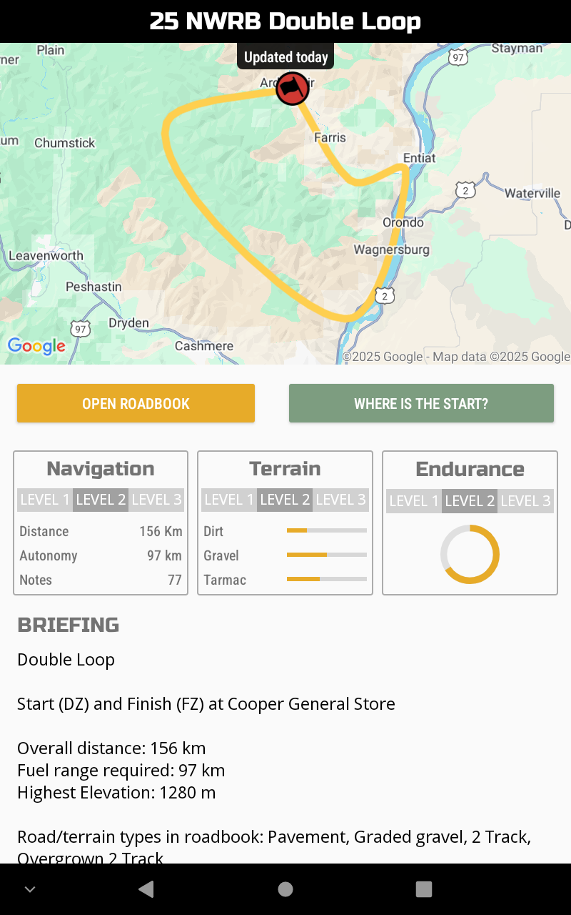
Double Loop
Start (DZ) and Finish (FZ) at Cooper General Store
Overall distance: 156 km
Fuel range required: 97 km
Highest elevation: 1570 m
Road/terrain types in roadbook: Pavement, Graded gravel, 2 Track, Overgrown 2 Track
General description: The first half begins with a trip up into the mountains west of Ardenvoir. You will enjoy some views as you make your way around before dropping back down and looping past the starting point. You will follow the Entiat River back down to its confluence with the Columbia River. The mighty Columbia will lead you south until you break off onto another fabulous climb back up into the mountains. The route will take you along some great roads which will become less and less traveled. Finally, you will descend on an overgrown and scenic 2 track grade. You will be wondering if this road is going to go thru but don’t worry, it does! Eventually the track opens and drops you down toward the Entiat River. From there it is just a quick strip of pavement back to the starting point.
Boundaries around roadbook area: N - Entiat River Road; E - Columbia River; S - WA-97; W - Chumstick Highway
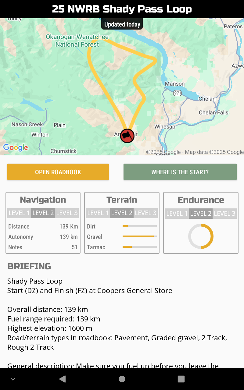
Shady Pass Loop
Start (DZ) and Finish (FZ) at Coopers General Store
Overall distance: 139 km
Fuel range required: 139 km
Highest elevation: 2030 m
Road/terrain types in roadbook: Pavement, Graded gravel, 2 Track, Rough 2 Track
General description: Make sure you have a full fuel tank before you leave the starting point. There is no fuel available along this roadbook. The route will take you along the Entiat River before climbing up to some fantastic viewpoints overlooking Lake Chelan and the surrounding mountains and valleys all around. This is a scenic one for sure! Eventually you will come down from the high country and catch a glimpse of pavement before climbing up yet again. More great views and photo opportunities will be there for you as you make your way south. The route will drop down into the Entiat Valley and return you to the starting point. Did we say it is scenic?? It is for sure!
Boundaries around roadbook area: N - Lake Chelan; E - WA-971; S - Entiat River Road; W - Shady Pass Road
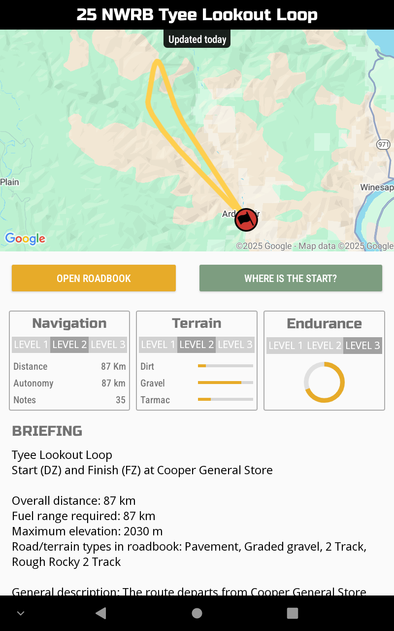
Tyee Lookout Loop
Start (DZ) and Finish (FZ) at Cooper General Store
Overall distance: 87 km
Fuel range required: 87 km
Maximum elevation: 2030 m
Road/terrain types in roadbook: Pavement, Graded gravel, 2 Track, Rough Rocky 2 Track
General description: The route departs from Cooper General Store and heads up one of the funnest, twistiest paved mountain roads in Washington. About the time you get used to the pavement and ripping around all those curves, it jumps off on a fun 2 track road. There are views all along the way. You rejoin the tarmac and continue upwards. If you look in the right direction, you may see the Tyee Lookout perched up on the mountain above. From the end of pavement, the route takes you up a rough section of rocky 2 track. The road degrades as you get higher until you are finally rewarded with the lookout. Take some time and enjoy the views. This is a great place for a snack. If you are riding a big bike or don’t feel up to the rocks, the roadbook provides guidance to skip that section up to the Tyee Lookout. Don’t worry, there are plenty of awesome views everywhere along this route. The route down is a fun one too. The roadbook will take you on some great gravel and 2 track roads on the way back down before finally putting you back on the twisty pavement down to the place you started. Make sure you have enough fuel in your tank before departing. There are no fuel stops along this route.
Boundaries around roadbook area: N - Entiat River Road; E - Entiat River Road; S - Cooper General Store; W – Entiat Mountain Range
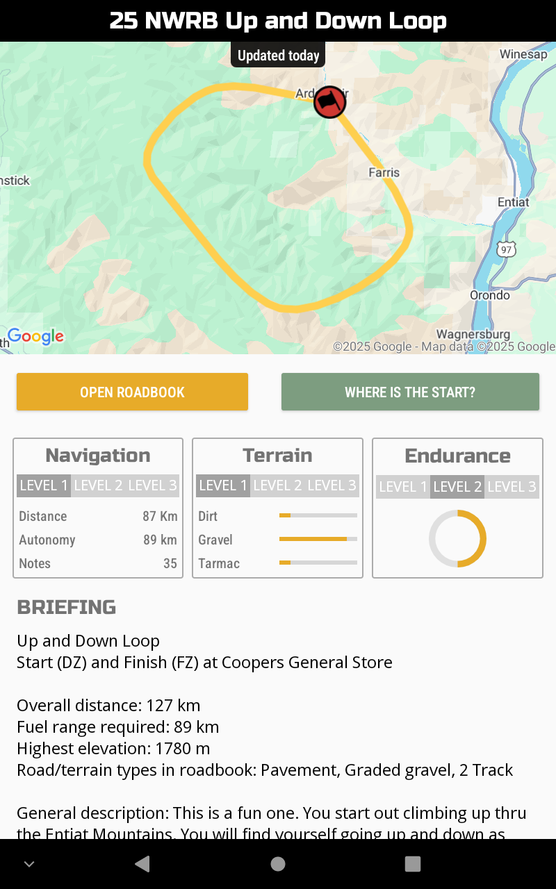
Up and Down Loop
Start (DZ) and Finish (FZ) at Coopers General Store
Overall distance: 127 km
Fuel range required: 89 km
Highest elevation: 1780 m
Road/terrain types in roadbook: Pavement, Graded gravel, 2 Track
General description: This is a fun one. You start out climbing up thru the Entiat Mountains. You will find yourself going up and down as you tour the ridges. Next comes a descent back into Ardenvoir. The route passes by the starting point before heading out for another climb back up into the range. You will be rewarded with one of the highest and best mountaintop viewpoints in the area. Stop and enjoy the view. Look around at all the ground you covered. You will drop down again before climbing back up to the ridgeline yet again. Finally, wrapping it all up is one of the best descents in the area. Up and Down. Such a great time!
Boundaries around roadbook area: N – Entiat River Road; E – Columbia River; S – WA-97; W – Chumstick Highway
