

Roadbook Club – Volumes 1, 2 and 3
Start Location: McCollum Pioneer Park, 600 128th St. SE, Everett, WA 98206
We have three Roadbook Tours for you to ride in this Roadbook Club set. Each of the 3 Volumes builds upon what you learned in the last to help you become more confident as you gain experience. The remove some of the fear of following a Roadbook Tour for the first time by being on public roads in an area you already know.
Each Roadbook Tour is on paved roadways and can be ridden on any motorcycle from a smaller dual-sport all the way up to a Goldwing. Get your Android tablet mounted, your power supply set up, and your TerraPirata Rally Roadbooks app loaded up and come out for some fun following the tulips.
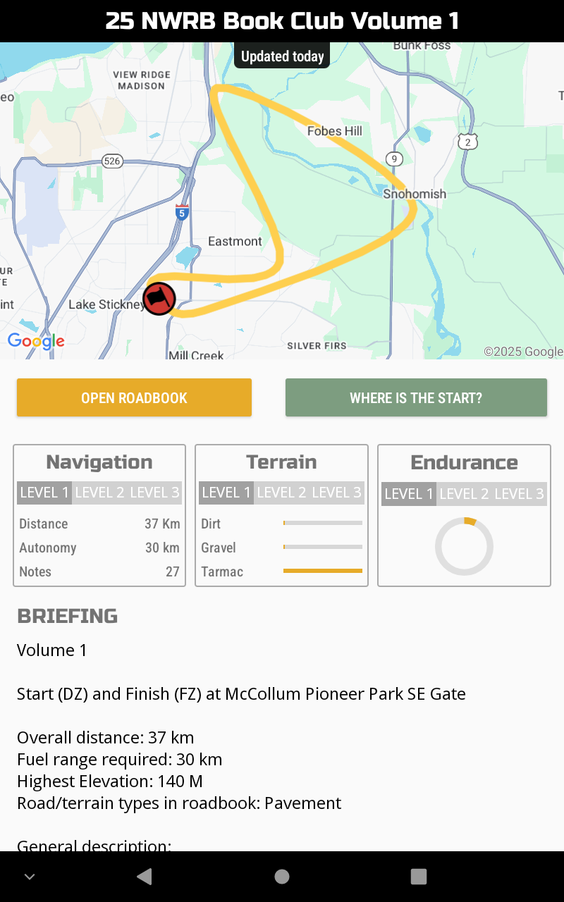
Volume 1
Start (DZ) and Finish (FZ) at McCollum Pioneer Park SE Gate
Overall distance: 37 km
Fuel range required: 30 km
Highest elevation: 140 m
Road/terrain types in roadbook: Pavement
General description:
Volume 1 takes you out for your first lesson on a nice paved loop thru farmland toward Snohomish and then back to the starting point. The navigation is straightforward and all of the notes have their GPS locations available to make it an easy route to get started with. Once you have it completed, move on to Number 2 to practice what you learned.
You will be riding thru neighborhoods. Be careful.
Try to concentrate on making a clean run, not going fast.
This is NOT a race! No hazards are marked.
Boundaries around roadbook area: N- Snohomish River, E- 109th Ave SE, S- 139th Street SE, W- Interstate 5
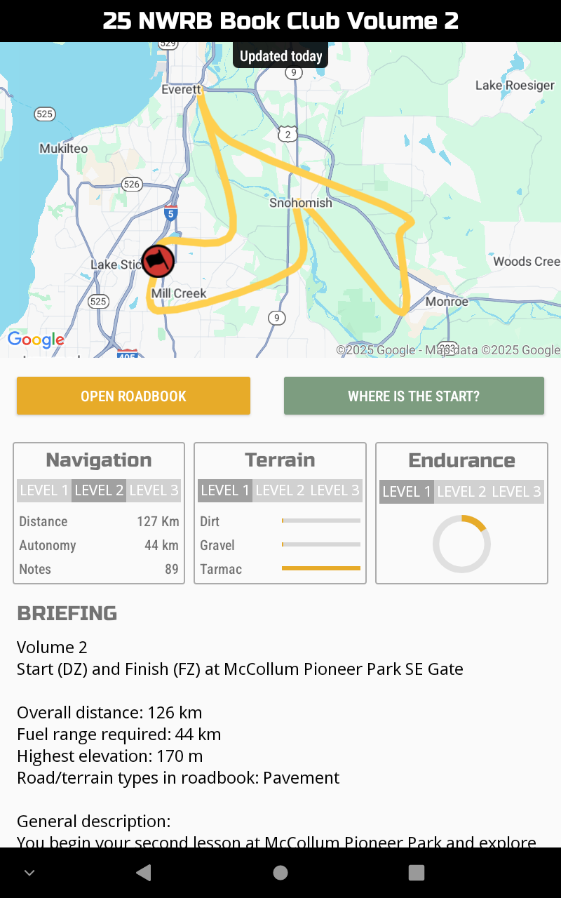
Volume 2
Start (DZ) and Finish (FZ) at McCollum Pioneer Park SE Gate
Overall distance: 126 km
Fuel range required: 44 km
Highest elevation: 170 m
Road/terrain types in roadbook: Pavement
General description:
You begin your second lesson at McCollum Pioneer Park and explore a bit more of Snohomish County on this Roadbook Tour. You will find yourself heading north toward Everett before exploring Ebey Island as you make your way toward Snohomish. Then you roll out into the foothills of SnoCo. You will come down, skirting the edge of Monroe. Next you will find yourself in more farmland on your way back to Snohomish again. Leaving Snohomish on more fabulous farmland roads as you make your way back toward the starting point.
The navigation is more challenging in this Roadbook Tour with more notes and more kilometers. You will not have GPS coordinates available for every note but only for a select few like the DSS, WPMs, ASS and fuel stops along the way. If you do find yourself lost, remember the best alternative is to go back to the last place you knew matched up with the roadbook, reset your odo to match it, and start again from there.
You will be riding thru neighborhoods. Be careful.
Try to concentrate on making a clean run, not going fast.
This is NOT a race! No hazards are marked.
Boundaries around roadbook area: N- 12th St SE, E- Woods Creek Rd, S- 164th St SE, W- I-5
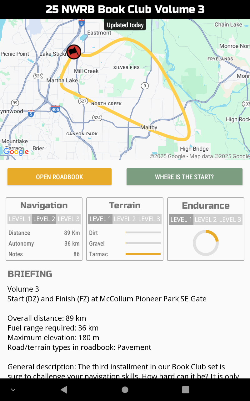
Volume 3
Start (DZ) and Finish (FZ) at McCollum Pioneer Park SE Gate
Overall distance: 89 km
Fuel range required: 36 km
Maximum elevation: 180 m
Road/terrain types in roadbook: Pavement
General description: The third installment in our Book Club set is sure to challenge your navigation skills. How hard can it be? It is only 89 km, right?? This one will surely have you backtracking to a known location at least once along the way. There are more notes per km which means more challenge.
You will start out going east (+/-) as you make your way over toward the Clearview area. Then down to the farmlands before exploring a bit of the Maltby area. Finally you will take what you learned so far into a tricky navigation area in Mill Creek before the roadbook returns you to the starting point.
You will be riding thru neighborhoods. Be careful.
Try to concentrate on making a clean run, not going fast.
This is NOT a race! No hazards are marked.
Boundaries around roadbook area: N – 116th St SE, E – Snohomish River, S – Sno/King County Line, W – I-5
Other nearby Northwest Roadbooks Tours include:
Mukilteo Factory Tour & SnoCo Foothills Tour
